Skip to content
View Jorge-Monge's full-sized avatar

Block or report Jorge-Monge

Block user

Prevent this user from interacting with your repositories and sending you notifications. Learn more about blocking users.

You must be logged in to block users.

Please don't include any personal information such as legal names or email addresses. Maximum 100 characters, markdown supported. This note will be visible to only you.
Report abuse

Contact GitHub support about this user’s behavior. Learn more about reporting abuse.

Report abuse
Jorge-Monge/README.md

Hi there

My name is Jorge Monge, and I am a GIS web developer with a background in architecture.

I live in Canada and work for Fujitsu Consulting, with a focus, right now, on geospatial web development with Javascript and React. I might be considered a "jack-of-all-trades" having worked in:

  • the back-end with NodeJS and C# .NET.
  • relational databases like PostgreSQL/GIS and SQL Server, including advanced SQL queries and functions/procedures.
  • the front-end with HTML/CSS/Vanilla JS, React, Bootstrap, and Tailwind CSS.
  • front-end mapping libraries like Leaflet and the ArcGIS JS API.
  • Python for a variety of things (automatic PDF mapping, Esri's ArcGIS Online content management, and many more)

I studied:

  • Architecture in the Universidad PolitΓ©cnica de Madrid (Masters degree)
  • Geographic Information Systems at the Southern Alberta Institute of Technology (SAIT) (Applied Bachelors degree)
  • Front-end web development at the University of Calgary (Certificate)
  • C# .NET development at the University of Calgary (Certificate, ongoing)
  • ... and I continue to study/learn every day!

Feel free to drop me a line at βœ‰οΈ gis@jorgemonge.ca or connect with me in Linkedin

Thanks! 😎

Income in Spain Project

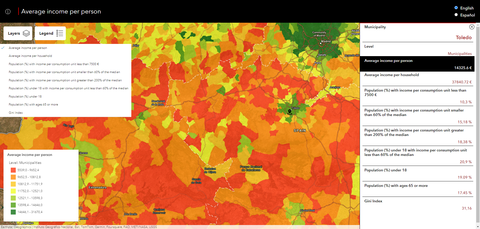
Income in Spain - ArcGIS Javascript API


JavaScript Python TypeScript HTML5 React CSS3 PostgreSQL

Pinned Loading

  1. leaflet_1 leaflet_1 Public

    A Leaflet map, allowing the user to upload/delete images and comments linked to a geographical position. Information (including images) is stored in a PostgreSQL DBaaS. Backend code with NodeJS usi…

    JavaScript 1

  2. income_spain_2020 income_spain_2020 Public

    A webmap built with React and the ArcGIS JS API, and consuming ArcGIS Online resources

    JavaScript 1

  3. cadastral_mapping cadastral_mapping Public

    Uses GeoPandas to map cadastral data for province capitals in Spain

    Jupyter Notebook 4 1