-
Notifications
You must be signed in to change notification settings - Fork 3.4k
New issue
Have a question about this project? Sign up for a free GitHub account to open an issue and contact its maintainers and the community.
By clicking “Sign up for GitHub”, you agree to our terms of service and privacy statement. We’ll occasionally send you account related emails.
Already on GitHub? Sign in to your account
Car profile go over steps #3435
Comments
|
Way we route over: https://www.openstreetmap.org/way/30019448#map=19/48.84148/2.31917&layers=D and nearby. Urgh this is bad. I'll dig in and investigate. Thanks for reporting! |
|
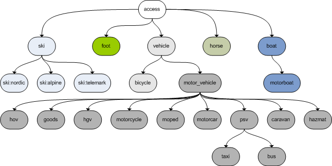
Here's the underlying issue: it's the https://wiki.openstreetmap.org/wiki/Key:access#Transport_mode_restrictions
Which means Check the query: http://overpass-turbo.eu/s/kBa
Most if not all of them should not be routed over with a car. On the other hand decoupling access tags from highway tags is confusing at best. cc @systemed let's continue the discussion from IRC here. |
|
The question is not if it's allowed or not (according to the OSM tags). But since it's steps, you can't go through due to physical issues because we are using a car. |
|
Interestingly enough here is the Wiki page for computing access restrictions: http://wiki.openstreetmap.org/wiki/Computing_access_restrictions#A_few_worked-out_examples
|
The question is: 1/ is it a tagging issue (we don't work around this) or 2/ is it a wrong access computation in the profiles (in which case we should fix the profiles). |
|
Or put another way: a. Follow wiki-defined tagging, in which I follow b) with cycle.travel, as my concern is "good routing" rather than "correct tagging". So, for example, routing over http://www.openstreetmap.org/way/184595087 gives http://cycle.travel/map?from=52.5319,13.4112&to=52.5314,13.412, where I'd suggest the same applies to the default car profile. If you follow a) then the routes will objectively be worse, but the tagging could be considered more correct and you may therefore encourage people to retag wrong/ambiguous examples. If you follow b) then the routes will be better, but the behaviour less correct according to the wiki. So essentially this is the result of the wiki not reflecting a lot of real-world tagging practice. What OSRM should do - well, it depends whether you prefer getting angry complaints from people who were told to drive their truck down some steps, or from wiki users who want their tagging style to be followed. ;) |
|
For me this is less of problem of wiki vs. real world but between having a well-defined behavior vs. what we come up with ourselves in each implementation. From our perspective it does not really matter what scheme is actually used for tagging as long as it is well defined. We can come up with our own scheme that is an alternative to what is written in the OSM wiki but then we also have the responsibility of communicating it clearly. From past experience going against "official" definition is very difficult (:wave: Hence my first impulse would be to stick to the "official" definition and develop tools that detect common mistaggings and fix that in the data. However this is not only a data problem, but also a tooling problem in my opinion. If JOSM and iD make it easy to use the |
|
I already wrote a tool to fight against misuse of access tag: |
|
It seems to me that access=yes mean that it's possible to go by car, while access=permissive merely means it's allowed, but not necessarily possible. Following this understanding it would make sense to blacklist certain way types when access=permissive. |
|
That really is a case of the wiki over-reaching. There are thousands of cycleways with |
|
Back to the original issue - we shouldn't send cars down steps. Unless someone can come up with an actual example where this is physically possible, we should change the profile to throw out any Hasn't anyone seen the Italian Job? Driving down steps is reserved for bank heist getaways, and route-planning for that should be limited to paper maps in criminal's basements. |


When way are steps (highway=steps) and access tag whitelist (eg access=permissive) the router profile can use the steps.
http://map.project-osrm.org/?z=18¢er=48.841233%2C2.318432&loc=48.841316%2C2.318099&loc=48.841030%2C2.318748&hl=en&alt=0
The text was updated successfully, but these errors were encountered: