Project Name: Signal - a live bushfire reporting app
Team Name: LitSquad (NSW)
Challenges:
Engaging communities in hazard reporting & safety (Challenge Link)
Improving government services with open data (Challenge Link)
Video Pitch: Link to Video Pitch
The Signal app allows the NSW Fire department to get live data about areas affected by the bushfires by allowing Australians to quickly and easily report if there is a fire in their area.
The app allows users in hazard-prone areas to submit a report if there is a bushfire in their location. This report is then approved by the NSW Rural Fire Service and is used to help support an emergency response.
Signal also creates a way for the RFS to communicate with the community, providing a community forum under each verified bushfire report.
-
Authentication: Users sign up with Google or AppleID and this ensures everyone submitting report has an account (reduces the rate of false/anonymous reports and abuse of the reporting feature).
-
Google Maps Layout of all Verified Reports with location pins: All verified reports are listed on the google map for all users to see. Benefits include that it is visual and that it’s an intuitive way to display reports near the users’ location. Both Datasets are used to also display known bushfire incidents on the map.
-
Submit report Button: A simple reporting feature that allows users to report a bushfire incident with a few simple clicks. Easy to understand. Quick and very visual.
-
Reporting form: When the Submit button is pressed, a reporting form comes up that asks users to upload an image of the fire/smoke which is sent to the RFS for verification. Use of image prevents abuse of the reporting feature as well as allowing the RFS to get additional information.
-
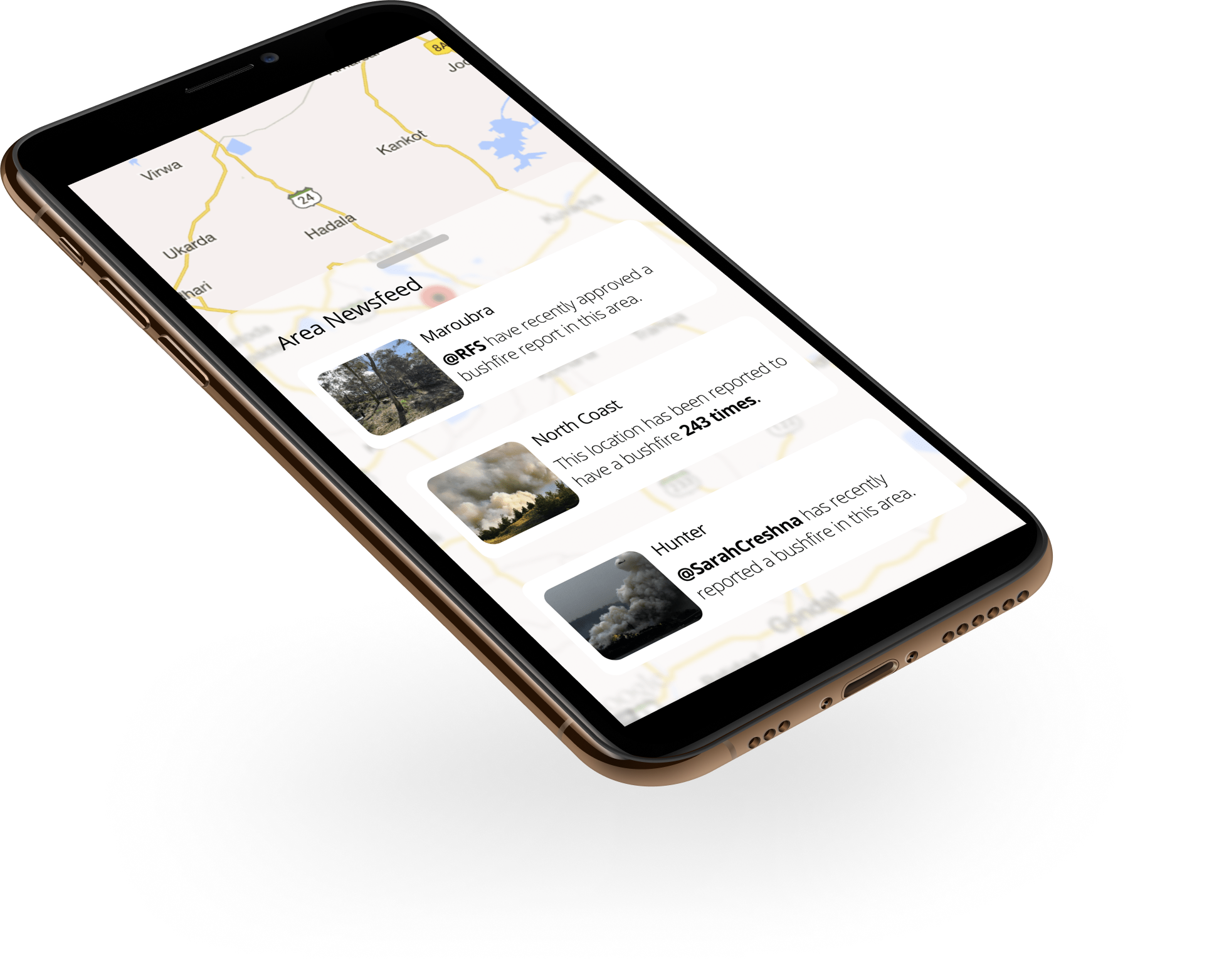
Bottom sheet with a feed of submitted reports: Bottom sheet displays a feed of recent activity on the app. This can help not only keep the general public informed about the RFS response but also allow the RFS to communicate with the community.
-
Report details shown when location on the map is clicked: Details of each report is shown when a marker on the map is clicked. These reports have been verified and also include updates to further facilitate communication between the RFS and the general public.
As a result of the 2019/2020 BushFires, at least 33 people have been killed (including four firefighters) and more than 11 million hectares of bush, forest and parks across Australia have burned.
Bushfire incidents were recorded by monitoring high-risk areas with helicopters, with a minimum of 1hr lag when it comes to displaying that information which has greatly impacted the RFS ability to respond effectively.
The importance of current and reliable information is paramount when it comes to emergencies. Thus, the app would play a key role in improving the RFS's information procurement processes.
The Signal app can:
- Drastically improves emergency response times
- Create a quick and reliable source of incident reporting for the NSW Fire department
- Allow effective communication between the community and the RFS to help them take action to better respond to future bushfires
- Drastically reduce the cost for RFS to retrieve information about bushfire incidents
We strongly believe the signal app will greatly contribute to the Rural Fire Service's mission to reduce the likelihood and consequence of fires occurring in Australia.
Vote for our project and help the heroes of Australia get the information they need!
 |
 |
 |
 |
 |
MIT License. © 2020, LitSquad.

